

Indonesia Curbs Access to Mount Bromo Viewpoint as Wildfires Burn East Java Park
Indonesian officials have limited tourist entry to the Penanjakan summit at Bromo Tengger Semeru National Park while crews battle uncontrolled blazes across the volcanic reserve.
By The Global Wire Newsroom · Reported from thestar.com.my
Link preview · horizonglobalnews.com
Indonesia Curbs Access to Mount Bromo Viewpoint as Wildfires Burn East Java Park
Indonesian officials have limited tourist entry to the Penanjakan summit at Bromo Tengger Semeru National Park while crews battle uncontrolled blazes across the volcanic reserve.
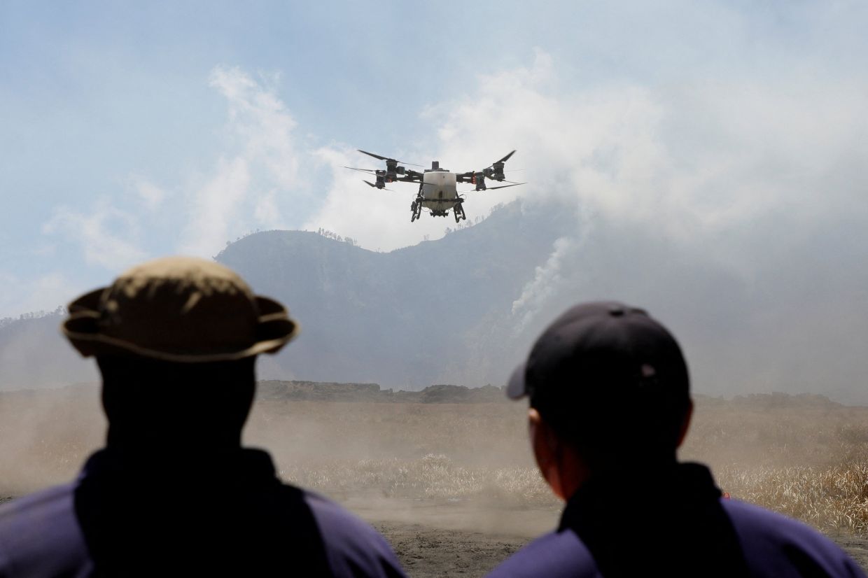
Indonesian conservation officials have closed off access to the prominent Penanjakan viewpoint overlooking Mount Bromo in East Java after wildfire activity spread through sectors of Bromo Tengger Semeru National Park. The containment effort remains underway across rugged volcanic terrain where shifting winds and dry vegetation have allowed fires to persist, forcing park administrators to restrict visitor traffic to one of the country's most frequented ecological tourism hubs to safeguard travelers and facilitate emergency response operations.
Key facts
What happened
Emergency management teams and forestry wardens moved to curtail public access to the Penanjakan viewing platform following the rapid emergence of vegetation fires within the higher elevations of Bromo Tengger Semeru National Park. Penanjakan, perched at an altitude of approximately 2,770 meters on the northern rim of the Tengger caldera, serves as the primary vantage point from which thousands of daily domestic and international travelers view sunrise over Mount Bromo, Mount Batok, and the distant Mount Semeru.
Field assessments indicated that uncontrolled fires burning through savanna brush and sub-alpine forest patches posed an immediate safety hazard along access roads and trails leading to the ridge. Dense smoke rolling across the caldera's perimeter diminished visibility, while erratic surface winds common to the high-altitude plateau threatened to push flames closer to public transit corridors used by local four-wheel-drive concessionaires.
Park authorities, operating under the Ministry of Environment and Forestry through the Bromo Tengger Semeru National Park Agency (Balai Besar Taman Nasional Bromo Tengger Semeru, or BB-TNBTS), activated response protocols. These measures involve deploying specialized forest firefighting squads, known locally as Manggala Agni, alongside joint teams of military personnel, national police officers, regional disaster mitigation personnel (BPBD), and community volunteers from the surrounding Tenggerese villages. Suppression teams have focused on cutting firebreaks and containing active flame fronts to prevent the fire from sweeping down into the Sand Sea—the massive caldera floor surrounding Mount Bromo's central crater—or spreading deeper into primary montane forests.
Why it matters
The shuttering of key observation platforms at Mount Bromo carries immediate economic and operational repercussions that extend far beyond park boundaries. Bromo Tengger Semeru National Park serves as the financial anchor for a broad tourism ecosystem in East Java, driving revenue across four adjacent administrative districts: Probolinggo, Pasuruan, Malang, and Lumajang. Thousands of local livelihoods depend directly on visitor access, including hundreds of licensed jeep operators who ferry tourists to Penanjakan in the early morning hours, horse rental guides from the indigenous Tengger community, homestay operators, and regional transport providers.
When park sectors close due to environmental crises, the disruption triggers immediate booking cancellations, stranded tour itineraries, and substantial daily revenue shortfalls for small and medium enterprises. A temporary suspension of scenic routes quickly cascades into lost bookings for hotels in nearby gateway towns like Sukapura, Tosari, and Ngadisari.
Ecologically, Bromo Tengger Semeru represents a vital upland watershed and a unique conservation reserve featuring montane biodiversity, endemic flora such as the Javanese edelweiss (*Anaphalis javanica*), and protected fauna including the Javan leopard (*Panthera pardus melas*). Repeated and uncontrolled burns strip away high-elevation vegetation that prevents soil erosion on sheer volcanic inclines. When seasonal rains eventually arrive, slopes denuded by wildfires face heightened risks of severe mudslides, flash flooding, and volcanic debris flows, endangering downstream agrarian communities.
The background
Bromo Tengger Semeru National Park spans roughly 50,276 hectares and preserves the ancient Tengger caldera, an expansive volcanic basin created by catastrophic prehistoric eruptions. Within this basin lie younger volcanic cones, chief among them the continuously active Mount Bromo, which frequently emits steam and low-level ash plumes, and the dramatic cone of Mount Batok. Rising to the south is Mount Semeru, the highest peak on Java and one of the island's most historically volatile stratovolcanoes.
The park's elevation profile ranges between 1,000 and nearly 3,700 meters above sea level, giving rise to distinct vegetation zones dominated by vast open savannas, grasslands, and acacia woodlands that alternate with dense tropical montane cover. During the peak dry season, which typically extends across Java between May and October, vegetation within the rain-shadowed highlands becomes brittle and intensely flammable. The dry landscape, compounded by stiff winds sweeping through caldera gaps, turns small spark sources into rapid, self-sustaining fire fronts.
Wildfires are not unprecedented in the park, but past incidents have underscored the extreme fragility of the highland ecosystem and the administrative challenges of managing mass tourism within an active volcanic area. In September 2023, a devastating blaze sparked by wedding visitors using theatrical smoke flares consumed more than 1,000 hectares of savanna and woodland across the Watangan hill sector and the caldera perimeter. That disaster prompted complete closures of the national park lasting over two weeks, cost billions of rupiah in direct firefighting expenditures and economic losses, and led to criminal prosecutions against the individuals responsible.
In the wake of past fires, Indonesian conservation authorities instituted stringent restrictions on the entry of open flames, pyrotechnics, and campfires, while implementing online ticketing systems to control visitor density. Despite these regulations, the park's immense expanse and numerous unmonitored trails make perimeter enforcement a persistent challenge for understaffed forestry patrols, especially when natural drought conditions peak.
Reaction
Regional authorities and local tourism syndicates have responded by redirecting visitor flows and urging compliance with official park agency bulletins. The park administration has urged domestic and foreign travelers to monitor official BB-TNBTS communication channels and avoid attempting to enter closed zones through unofficial backcountry routes. Regional disaster mitigation agencies across Pasuruan and Probolinggo have mobilized logistical support, dispatching water tenders, specialized hand tools, and breathing apparatus to base camps near the caldera rim.
Local jeep drivers' associations, which operate thousands of vintage vehicles across the park floor, have coordinated with park wardens to adjust scenic loops, routing clients toward alternate viewpoints outside the active smoke corridors where authorities have deemed conditions safe. Environmental advocacy groups in East Java have historically called for more permanent structural improvements to forest monitoring systems, pointing to satellite thermal sensors and rapid aerial water-bombing capacity as essential prerequisites for managing Java's climate-vulnerable national parks during dry spells.
Regional government bodies are anticipated to evaluate the broader safety situation in joint inter-agency briefings, where the regional governors and police leadership routinely review emergency civil defense decrees if air quality metrics in nearby residential settlements fall below national safety thresholds.
What we don't know yet
Several critical elements of the ongoing incident remain unverified in the immediate aftermath of the viewpoint restriction. Official reports have not yet quantified the precise surface area burned by the active fires, nor have authorities publicly identified the exact ignition point or confirmed whether the fire originated from natural combustion, agricultural clearing along boundary zones, or human negligence inside the reserve. The specific duration of the access restriction at Penanjakan remains open-ended, contingent entirely upon real-time containment progress and wind trajectory shifts.
Furthermore, official casualty and asset damage assessments have not been published. While no civilian injuries have been verified, it remains unclear whether any emergency personnel have suffered smoke-related respiratory trauma or whether physical infrastructure, such as guard posts, wooden walkways, telecommunication relays, or vendor stalls along the Penanjakan ridge, have sustained fire damage. Finally, authorities have not stated whether water-bombing aircraft from the National Disaster Management Authority (BNPB) will be dispatched to augment ground crews battling flames on inaccessible cliff sides.
What to watch
The immediate trajectory of the crisis hinges on regional meteorological patterns over the coming days. Observers and travel operators should watch for whether the Indonesian Agency for Meteorology, Climatology, and Geophysics (BMKG) forecasts shifting wind patterns, sustained high temperatures, or early localized precipitation that could assist containment efforts. Continued dry winds will complicate ground containment and could force park management to broaden access bans from the Penanjakan peak to adjacent viewpoints such as Kingkong Hill, Bukit Cinta, or the caldera floor itself.
A crucial milestone will be the park administration's next formal status assessment, which will determine whether the restriction remains partial or transitions into an indefinite, park-wide shutdown reminiscent of previous ecological crises. Readers should also monitor official statements from the Ministry of Environment and Forestry regarding the cause of the fire and potential enforcement actions if human culpability is established. For regional businesses, the upcoming operational reviews from East Java's provincial tourism board will indicate the preliminary economic losses sustained by hospitality and transport sectors reliant on Bromo's year-round foot traffic.
This article incorporates reporting originally published by thestar.com.my.
How this story was produced
This report was written by The Global Wire newsroom from reporting first published by thestar.com.my. We verify the core facts against the original report, write our own account, and add the background and consequences a short wire item leaves out. Drafting is AI-assisted inside an editor-supervised pipeline, and every story is checked for accuracy of attribution, structure and duplication before it appears — full detail in our AI and funding disclosure.
Spotted an error? Tell us at corrections@horizonglobalnews.com and read our corrections policy or editorial standards.





Reader comments
Loading comments…