

MIT Develops AI Framework to Model Unprecedented Climate Extremes Beyond Historical Records
A new machine-learning model developed at MIT simulates physically plausible severe weather events that exceed historical records, offering cities a tool to stress-test critical infrastructure.
By The Global Wire Newsroom · Reported from TOI Science Desk
Link preview · horizonglobalnews.com
MIT Develops AI Framework to Model Unprecedented Climate Extremes Beyond Historical Records
A new machine-learning model developed at MIT simulates physically plausible severe weather events that exceed historical records, offering cities a tool to stress-test critical infrastructure.
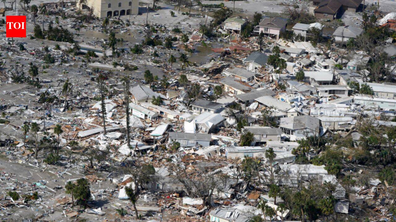
Scientists at the Massachusetts Institute of Technology have built a machine-learning framework capable of modeling unprecedented climate events, offering urban planners and climate risk analysts a tool to simulate disaster scenarios beyond recorded history. The artificial intelligence system generates physically plausible atmospheric models for severe events that have never occurred in modern observational records, according to reporting published by TOI Science Desk in August 2026. As a benchmark demonstration, researchers applied the framework to simulate a hypothetical 300-millimeter single-day rainfall event over New York City—a figure that drastically exceeds the city's historical recorded maximum of approximately 200 millimeters. By synthesizing atmospheric physics into generative machine-learning algorithms, the tool bridges a critical gap in climate resiliency: enabling infrastructure to be designed not for the worst events of the past, but for the unprecedented extremes of a changing climate.
Key facts
What happened
The development addresses one of the most stubborn computational bottlenecks in atmospheric science: simulating physical catastrophes that have no prior observational baseline. Traditional artificial intelligence models trained on historical meteorological reanalysis data perform well at predicting familiar weather patterns. However, when pushed to forecast conditions outside their training distribution, standard deep-learning architectures often produce physically impossible results or revert toward historical averages.
To overcome this, the MIT research team constructed a physics-informed machine-learning architecture tailored for extreme value simulation. Rather than relying purely on empirical pattern recognition, the system enforces fundamental physical constraints, including the conservation of mass, momentum, and thermal energy within atmospheric columns. This ensures that when the artificial intelligence projects an extreme scenario, the resulting weather fields—such as wind velocity, barometric pressure, atmospheric moisture content, and surface temperature—remain physically consistent.
In testing the system, researchers evaluated how a catastrophic atmospheric disturbance could manifest over the New York metropolitan region. Historical records indicate that New York City's highest single-day precipitation accumulation stands near 200 millimeters. The MIT framework generated detailed, localized simulations of a plausible storm capable of delivering 300 millimeters of rainfall—a 50 percent increase above known observational records.
The resulting output provides a spatially explicit, time-resolved mapping of how such a storm would move across urban topography. It identifies how moisture-laden air masses could stall over specific watershed catchments, triggering compound flash flooding across low-lying neighborhoods, underground transit corridors, and critical highway infrastructure.
Why it matters
The ability to generate physically coherent, unprecedented storm scenarios represents a significant shift for public infrastructure, climate adaptation policy, municipal finance, and the global insurance industry.
For decades, civil engineers and city planners have designed public works using historical flood risk maps prepared by government agencies. In the United States, the Federal Emergency Management Agency produces maps based on statistical analyses of stream gauge records and rainfall data collected over the preceding 50 to 100 years. These maps establish building codes, zoning regulations, and elevation requirements for critical infrastructure like water treatment plants and transit networks.
However, historical records are increasingly unreliable guides for future risk. Under the Clausius-Clapeyron relation, every 1 degree Celsius increase in global mean atmospheric temperature enables the atmosphere to hold approximately 7 percent more water vapor. As global temperatures rise, storm systems absorb greater quantities of moisture, leading to higher precipitation intensity during severe storms.
If municipal planning remains anchored to historical upper bounds, newly constructed infrastructure will remain under-designed for mid-century conditions. A 300-millimeter rainfall event in New York City, as simulated by the MIT framework, would overwhelm standard storm-sewer networks designed for lower volumetric thresholds. Such an event would risk catastrophic inundation of subway tunnels, subterranean electrical vaults, and residential areas.
Beyond physical planning, the technology holds direct implications for insurance. Reinsurance companies rely on catastrophe models to determine capital reserve requirements and underwrite property risks. Models that fail to anticipate unobserved tail risks can lead to sudden market destabilization or post-disaster insolvency. By providing granular simulations of theoretical extremes, the MIT tool enables insurers and bond rating agencies to conduct realistic financial stress testing.
The background
The challenge of predicting rare, severe weather events has traditionally been divided between two computational methodologies, both of which suffer from structural limitations.
The first approach relies on global circulation models and numerical weather prediction systems. These physics-based computational engines solve fluid dynamics equations across three-dimensional grids surrounding the globe. While physically rigorous, high-resolution global circulation models require massive supercomputing power. Running enough high-resolution ensemble iterations to catch extremely rare events—such as a 1-in-500-year storm—requires immense computational resources and time, making comprehensive tail-risk exploration computationally prohibitive for municipal planning departments.
The second historical approach relies on statistical mathematics, specifically extreme value theory. Extreme value theory fits parametric probability distributions to historical station records to extrapolate return periods for unobserved events. However, extreme value theory relies on the core assumption of climate stationarity—the principle that natural systems fluctuate within an unchanging envelope of variability. The rapid acceleration of climate change has invalidated stationarity. Extrapolating historical distributions in a non-stationary climate frequently leads to severe underestimation of future event frequency and magnitude.
In recent years, deep-learning models trained on decades of global weather reanalysis data—such as the European Centre for Medium-Range Weather Forecasts' ERA5 dataset, which catalogs atmospheric parameters from 1979 to the present—have transformed short-term weather forecasting. Systems like Google DeepMind's GraphCast and Nvidia's FourCastNet can generate five-day global forecasts in seconds on single graphics processing units. However, because these neural networks learn exclusively from historical reanalysis, they struggle when tasked with predicting events that exceed maximum values present in their training sets.
Recent historical events have demonstrated the real-world danger of relying on historical caps. In September 2021, the remnants of Hurricane Ida dropped over 80 millimeters of rainfall in a single hour over Central Park, setting a short-duration record for New York City and flooding subways. In June 2021, an extraordinary heat dome over the Pacific Northwest pushed temperatures in Lytton, British Columbia, to 49.6 degrees Celsius, obliterating previous national records by nearly 5 degrees Celsius—an outcome that standard models had calculated as statistically near-impossible under historical distributions.
Reaction
Following the report by TOI Science Desk, climate scientists, urban resiliency officers, and risk management specialists are expected to evaluate how the physics-informed AI system can be integrated into existing disaster response and infrastructure frameworks.
Atmospheric researchers are anticipated to focus on validating the model's physical constraints across diverse global topographies, ensuring that synthetic storms generated in coastal regions, mountainous zones, and inland river basins consistently reflect local thermodynamic realities. Civil engineering associations are expected to review whether synthetic tail-risk data can be incorporated into revised building codes and stormwater management manuals.
Financial institutions and municipal bond issuers are also watching the development closely. Rating agencies increasingly require cities to disclose physical climate risks before issuing long-term municipal bonds for infrastructure projects. Demonstrating the capacity to model and withstand unprecedented climate shocks could become a standard requirement for maintaining credit ratings in coastal metropolitan areas.
What we don't know yet
Despite the promising capabilities of the MIT framework, several technical and operational questions remain unanswered.
It remains unclear how easily the model can be scaled and calibrated for geographical settings with limited historical meteorological monitoring stations, such as regions across the Global South. While major urban centers like New York City possess dense networks of weather stations and radar coverage spanning more than a century, developing regions often lack high-density observational data, which could affect the grounding of machine-learning baselines.
Additionally, validation presents an inherent paradox. Because the system is specifically designed to simulate unprecedented extreme events, direct empirical validation of its highest-intensity outputs is impossible until a comparable disaster actually occurs. Researchers must rely on surrogate validation techniques, such as testing whether the model can accurately recreate historical extreme events when trained on truncated datasets that exclude those events.
Finally, specific details regarding public access, computational overhead, and distribution licensing have not been fully outlined. It is unknown whether MIT plans to release the model as open-source software for public urban planning agencies worldwide or license the framework through private climate analytics partnerships.
What to watch
In the coming months, several key milestones will clarify the practical impact of the research:
This report is based on original science reporting by TOI Science Desk.
How this story was produced
This report was written by The Global Wire newsroom from reporting first published by TOI Science Desk. We verify the core facts against the original report, write our own account, and add the background and consequences a short wire item leaves out. Drafting is AI-assisted inside an editor-supervised pipeline, and every story is checked for accuracy of attribution, structure and duplication before it appears — full detail in our AI and funding disclosure.
Spotted an error? Tell us at corrections@horizonglobalnews.com and read our corrections policy or editorial standards.

Reader comments
Loading comments…