

China Deploys Deep-Sea Robotic Submersible Capable of Reaching 14,764 Feet in South China Sea
Chinese researchers have initiated a deep-ocean scientific exploration mission in the South China Sea using a robotic submersible designed to dive nearly 15,000 feet.
By The Global Wire Newsroom · Reported from Kaif Shaikh
Link preview · horizonglobalnews.com
China Deploys Deep-Sea Robotic Submersible Capable of Reaching 14,764 Feet in South China Sea
Chinese researchers have initiated a deep-ocean scientific exploration mission in the South China Sea using a robotic submersible designed to dive nearly 15,000 feet.
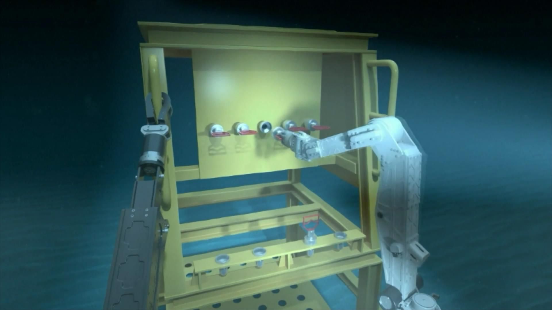
On September 30, 2026, China launched a scientific exploration mission in the South China Sea utilizing a newly deployed robotic submersible designed to operate at depths up to 14,764 feet (4,500 meters). The mission represents a major technical deployment for Chinese marine scientists seeking to investigate the ocean floor, analyze deep-sea ecosystems, and collect geological data in one of the Western Pacific's most complex marine environments. Operating where sunlight cannot penetrate and ambient pressure reaches extreme levels, the robotic vessel provides high-precision surveying and sampling capabilities without risking human crews. The launch underscores an ongoing expansion of deep-ocean research infrastructure across regional waters.
Key facts
What happened
On September 30, 2026, scientific teams deployed a high-depth robotic submersible into the South China Sea for an oceanographic mission, according to reporting by Kaif Shaikh. The submersible is rated for operations down to 14,764 feet, placing it among an elite class of research vessels capable of reaching deep ocean floors.
Operations at depths near 15,000 feet require specialized support infrastructure and complex maritime logistics. Submersibles of this class are lowered from dedicated oceanographic research vessels equipped with dynamic positioning, heavy-lift cranes, and armored umbilical cables or acoustic links. Once deployed, the submersible descends through the upper water column into the bathypelagic region before reaching the seabed.
During deep-water survey operations, uncrewed robotic submersibles execute grid paths across the seafloor. Equipped with multi-beam acoustic sonar, high-definition optical cameras, and LED lighting arrays, the vehicles create detailed three-dimensional maps of subsea terrain. Robotic manipulators allow operators to collect core samples of marine sediments, rocks, and biological specimens. Integrated sensors record oceanographic data including temperature, salinity, turbidity, and chemical concentrations linked to underwater gas seeps or thermal vents.
The primary site, the South China Sea, features a vast central ocean basin where depths exceed 4,000 meters. Scientific missions in this zone aim to refine structural geology models, map submarine canyons, and catalog extreme-environment biology residing near cold seeps and abyssal plains.
Why it matters
The deployment of a 14,764-foot-class robotic submersible carries scientific, economic, and technological significance for oceanography and marine resource management.
Scientifically, ocean environments below 3,000 meters remain largely unexplored. High-depth robotic craft enable scientists to investigate biological communities that exist independently of solar energy. Deep-sea ecosystems, particularly those near cold seeps and hydrothermal vents, rely on chemosynthetic bacteria that derive energy from methane and hydrogen sulfide. Cataloging these extremophilic organisms provides key insights for evolutionary biology and potential biochemical research.
Geologically, fine-scale mapping at depths near 15,000 feet yields baseline data for understanding global ocean circulation, carbon storage, and subsea tectonic activity. The deep basin of the South China Sea functions as a depositional sink for continental river sediment, preserving a long-term geological record of historical climate patterns.
Technologically, operating submersibles at 4,500 meters demonstrates advanced capabilities in materials science, underwater communications, power storage, and robotic automation. Seafloor mapping and core sampling inform assessments of deep-sea mineral deposits, including polymetallic crusts, manganese nodules, and methane hydrates. Additionally, bathymetric surveys assist in routing subsea telecommunications cables and identifying physical hazards to subsea infrastructure.
The background
The deployment of this 14,764-foot robotic submersible reflects a long-term strategy by Chinese research institutions to build an oceanographic fleet capable of operating across all ocean depths, from continental shelves to deep trenches.
China's deep-sea program has expanded steadily over the past two decades. Key milestones include the crewed submersible Jiaolong, which reached 7,062 meters (23,169 feet) in June 2012 in the Mariana Trench area. In 2017, China introduced Shenhai Yongshi ("Deep Sea Warrior"), a crewed submersible engineered for depths up to 4,500 meters (14,764 feet) with high domestic component content, including titanium alloy pressure spheres and syntactic foam buoyancy blocks. In November 2020, the full-depth crewed submersible Fendouzhe ("Striver") descended 10,909 meters (35,790 feet) to the bottom of the Challenger Deep.
Parallel to crewed submersibles, uncrewed platforms have become essential tools for marine research. These include Remotely Operated Vehicles (ROVs), connected to surface ships by fiber-optic umbilical cables delivering power and telemetry, and Autonomous Underwater Vehicles (AUVs), which navigate untethered using internal battery power and automated programming.
Operating at 14,764 feet subjects submersibles to immense hydrostatic forces. Ocean pressure increases by approximately one atmosphere (14.7 pounds per square inch) for every 10 meters of depth. At 4,500 meters, ambient pressure reaches roughly 440 atmospheres—exceeding 6,500 pounds per square inch. To withstand these forces, submersibles utilize specialized materials. Buoyancy is provided by syntactic foam—a composite of hollow glass microspheres embedded in epoxy resin—while electronics are housed inside titanium pressure hulls or fluid-compensated enclosures.
The South China Sea covers roughly 3.5 million square kilometers (1.35 million square miles) in the Western Pacific Ocean. Bordered by shallow continental shelves to the north and southwest, its central area contains a deep oceanic basin dropping below 4,000 meters. The sea's complex geological structure makes it a key target for marine oceanographic research.
Reaction
The launch of the deep-sea exploration mission has drawn interest across scientific and international monitoring communities.
Oceanographers and marine biologists broadly support expanding the deployment of high-depth robotic platforms, noting that empirical data from bathypelagic zones remains sparse globally. Scientists point out that uncrewed submersibles permit longer underwater operations and safer data collection than crewed vessels, facilitating detailed environmental baseline studies.
State oceanographic agencies and scientific institutions supporting China's deep-sea initiatives emphasize the deployment as evidence of growing domestic technical capabilities in marine robotics and autonomous underwater systems. Official research objectives focus on mapping seafloor geology, assessing marine biodiversity, and expanding deep-ocean surveying capacity.
From a geopolitical and maritime policy standpoint, regional observers monitor deep-sea scientific activities in the South China Sea carefully. Hydrographic mapping, subsea acoustic surveying, and seabed exploration involve technologies with potential dual-use applications—such as underwater positioning, submarine navigation assistance, and subsea infrastructure mapping—meaning scientific surveys in regional waters often attract international observation.
What we don't know yet
Despite reported details regarding the vehicle's depth rating and deployment zone, several operational parameters remain unspecified in available reporting.
First, the specific vehicle classification and official name of the robotic submersible—whether it operates strictly as a tethered Remotely Operated Vehicle (ROV), an autonomous AUV, or a hybrid system—have not been disclosed. Specifications regarding its payload capacity, manipulator tools, and battery endurance are currently unconfirmed.
Second, the exact geographic coordinates of the mission within the South China Sea basin have not been released. Because the basin covers a vast area with diverse seabed structures, the specific geological features targeted during this mission remain unknown.
Third, the identity of the surface oceanographic research vessel supporting the dive, the planned mission duration, and the full list of participating research institutes have not been detailed. Furthermore, it is unconfirmed whether collected bathymetric data and biological samples will be made publicly available through international oceanographic data repositories.
What to watch
Key developments to monitor in evaluating the progress and outcome of the deep-sea robotic mission include:
This report is based on original reporting by Kaif Shaikh.
How this story was produced
This report was written by The Global Wire newsroom from reporting first published by Kaif Shaikh. We verify the core facts against the original report, write our own account, and add the background and consequences a short wire item leaves out. Drafting is AI-assisted inside an editor-supervised pipeline, and every story is checked for accuracy of attribution, structure and duplication before it appears — full detail in our AI and funding disclosure.
Spotted an error? Tell us at corrections@horizonglobalnews.com and read our corrections policy or editorial standards.

Reader comments
Loading comments…