

Atlantic Hurricane Season Shows Early Inactivity Amid Extreme Model Predictions
Despite a quiet start to the Atlantic hurricane season, advanced meteorological models are outputting unprecedented forecasts that point toward unusual atmospheric instability.
By The Global Wire Newsroom · Reported from Eric Berger
Link preview · horizonglobalnews.com
Atlantic Hurricane Season Shows Early Inactivity Amid Extreme Model Predictions
Despite a quiet start to the Atlantic hurricane season, advanced meteorological models are outputting unprecedented forecasts that point toward unusual atmospheric instability.
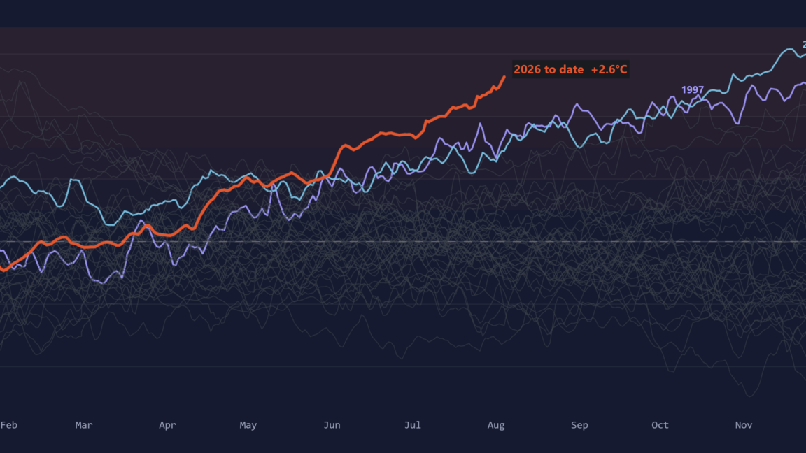
A deceptively quiet start to the Atlantic hurricane season has masked emerging atmospheric conditions that could lead to an atypical and severe turn in tropical activity, according to analysis by veteran weather journalist Eric Berger. While initial basin activity has remained markedly subdued, long-range numerical weather prediction models are generating outputs that diverge sharply from historical baselines. Meteorologists monitoring the Atlantic face a complex landscape where surface-level tranquility contrasts with deep-seated thermodynamic potential across the tropical basin.
Unprecedented Model Signals
The core of the concern lies in computer guidance systems that project atmospheric setups never previously recorded in modern observational history. As detailed in reporting by Eric Berger, weather models are forecasting conditions that fall well outside the known envelope of anything previously observed by atmospheric scientists.
In tropical meteorology, forecast models rely heavily on historical analogs—past weather patterns that share similar characteristics with current conditions—to project storm development, movement, and intensity. When dynamical systems generate projections that lack historical precedents, forecasters enter uncharted territory. The projections indicate that while the early weeks of the season may suggest a dormant year, the underlying environmental factors are assembling in a manner that could yield heightened atmospheric consequences later in the period.
The Mechanics of Seasonal Inactivity
The Atlantic hurricane season, which officially spans from June 1 through November 30, typically experiences its most rapid acceleration between mid-August and mid-October. Early-season inactivity, often characterized by a lack of named tropical cyclones, can be driven by several temporary suppressing factors.
In typical Atlantic setups, early-season suppression often stems from broad plumes of dry, dust-laden air originating over the Sahara Desert, known as the Saharan Air Layer. This dry air, combined with high levels of vertical wind shear—the change in wind speed and direction with height—can disrupt tropical waves before they organize into closed cyclonic circulations. Furthermore, localized sinking air motion, or subsidence, can prevent the deep convection required for thunderous cloud towers to build into tropical depressions.
However, atmospheric scientists emphasize that quiet conditions during the early months of summer do not guarantee a benign season overall. Inhibiting factors like dust and wind shear frequently dissipate as peak seasonal alignment approaches, exposing warmer waters beneath.
Ocean Thermal Energy and Environmental Anomalies
While atmospheric suppression can temporarily prevent storm formation, ocean heat content continues to accumulate beneath the surface. Tropical cyclones rely on warm ocean waters, typically requiring sea surface temperatures of at least 26.5 degrees Celsius (80 degrees Fahrenheit), as their primary fuel source.
When storm activity is delayed or absent during the early summer, sea surface temperatures across the Main Development Region—the swath of the tropical Atlantic between West Africa and the Caribbean Sea—often rise uninhibited. Solar radiation continually warms the upper layer of the ocean without the cooling mechanisms typically provided by tropical storms, such as vertical ocean mixing and atmospheric heat transfer.
According to the analysis published by Berger, the convergence of suppressed early activity with extreme oceanic and atmospheric anomalies creates a potentially dangerous offset. The accumulation of unspent thermal energy in the basin provides a vast reservoir of latent heat. Should atmospheric stability lessen and wind shear drop, this stored energy can fuel rapid intensification of tropical systems later in the cycle.
Forecasting Beyond Historical Envelopes
The emergence of model runs predicting conditions outside historical bounds presents significant operational challenges for atmospheric scientists and emergency planning officials. Global forecasting systems utilize complex fluid dynamics equations to simulate future atmospheric states over days and weeks.
When these computational models project scenarios that fall outside previous observational records, confidence intervals widen. Meteorologists must evaluate whether the extreme model outputs represent physical reality or algorithmic anomalies resulting from rapid shifts in global baseline climate conditions.
In recent years, ocean temperatures across the Atlantic basin have frequently reached record levels, challenging established statistical relationships used in seasonal hurricane outlooks. As traditional historical benchmarks become less reliable predictors of future behavior, forecasters increasingly rely on ensemble modeling—running dozens of simulations with slightly altered initial conditions—to gauge the probability of unprecedented atmospheric events.
The Risks of Public Complacency
One of the major hazards associated with a slow start to the hurricane season is the potential for public complacency along vulnerable coastal areas. When the early months of the season pass without major landfalling storms, residents and local infrastructure officials may lower their state of readiness.
Meteorological history demonstrates that quiet early seasons can nevertheless produce destructive landfalling hurricanes. A prominent pattern in historical climate records includes seasons where overall storm counts were average or below average, yet individual high-intensity systems caused catastrophic impacts upon making landfall.
The current model projections highlighted by Berger underscore the risk of assuming that early tranquility will persist. Emergency management officials routinely emphasize that seasonal totals matter far less to coastal communities than the trajectory and intensity of individual storms.
Outlook for the Peak Basin Transition
As the Atlantic basin moves deeper into the late summer, atmospheric conditions traditionally undergo a structural transition. The atmospheric waves moving off the western coast of Africa typically become more organized, while climatological factors align toward peak seasonal activity.
Forecasters will be watching closely for signs that the suppressing atmospheric conditions are breaking down, allowing the accumulated oceanic energy to interact with incoming tropical waves. The extreme scenarios flagged by current computer models suggest that if the basin transitions out of its quiet state, the subsequent activity could materialize rapidly and with unusual severity.
Reporting for this article was based on original analysis and reporting by Eric Berger.
How this story was produced
This report was written by The Global Wire newsroom from reporting first published by Eric Berger. We verify the core facts against the original report, write our own account, and add the background and consequences a short wire item leaves out. Drafting is AI-assisted inside an editor-supervised pipeline, and every story is checked for accuracy of attribution, structure and duplication before it appears — full detail in our AI and funding disclosure.
Spotted an error? Tell us at corrections@horizonglobalnews.com and read our corrections policy or editorial standards.


Reader comments
Loading comments…