

Superyacht Data Trial Demonstrates How Private Vessels Can Validate Ocean Satellites
An automated sensor package tested aboard the 68-metre yacht Archimedes shows how luxury vessels can collect high-precision surface data to calibrate Earth-observing satellites.
By The Global Wire Newsroom · Reported from TOI Science Desk
Link preview · horizonglobalnews.com
Superyacht Data Trial Demonstrates How Private Vessels Can Validate Ocean Satellites
An automated sensor package tested aboard the 68-metre yacht Archimedes shows how luxury vessels can collect high-precision surface data to calibrate Earth-observing satellites.
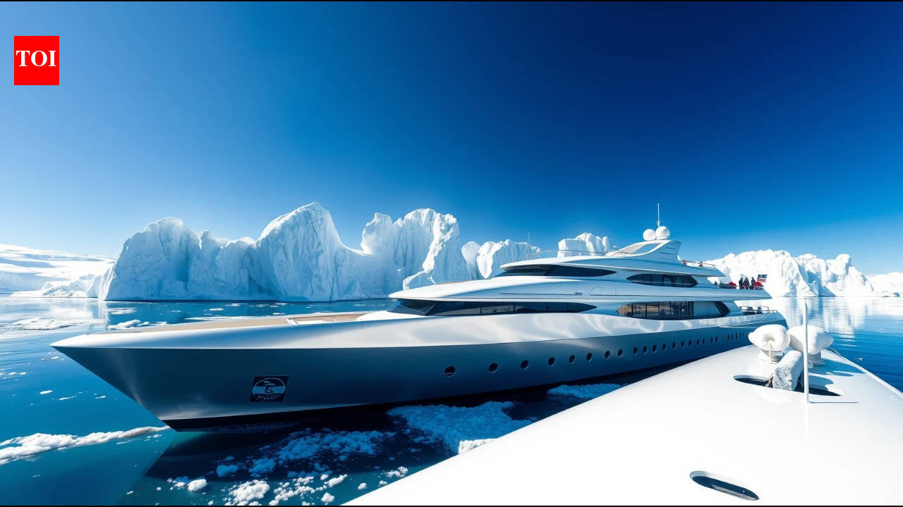
A multi-year field experiment testing whether private luxury yachts can serve as scientific platforms has shown that autonomous oceanographic sensors mounted aboard private vessels can effectively gather data to calibrate Earth-observing satellites. Between 2018 and 2020, researchers deployed an autonomous measurement system valued at $80,000 aboard the 68-metre superyacht Archimedes, owned at the time by the late hedge fund founder and mathematician James Simons and his wife, Marilyn Simons. The system continuously recorded surface ocean parameters during normal vessel operations, generating high-precision environmental observations along routes rarely covered by specialized scientific fleets or commercial cargo vessels.
Key facts
What happened
During a series of maritime voyages conducted between 2018 and 2020, ocean scientists installed and operated an autonomous ocean measurement package on board the 68-metre superyacht Archimedes. The custom-configured setup, valued at approximately $80,000, was designed to operate continuously while the vessel navigated standard private itineraries across open water.
According to reporting by TOI Science Desk, the experiment aimed to resolve a fundamental challenge in marine science: obtaining high-quality, real-time measurements of the upper ocean layer to verify satellite remote-sensing data. Satellite instruments orbiting hundreds of kilometers above Earth capture broad thermal, optical, and salinity signatures across the world's oceans. However, these spaceborne sensors require continuous validation against direct surface measurements—a process known as ground truthing or sea-truth verification—to correct for atmospheric distortion, sensor degradation, and local water column variability.
The autonomous equipment mounted on Archimedes sampled surface water while the vessel was underway, logging oceanographic metrics such as surface temperature, salinity, and optical properties. The automated configuration allowed the collection of continuous environmental data without requiring a dedicated scientific crew to manage daily operations. Researchers then compared the vessel's high-resolution surface observations against corresponding readings taken by Earth observation satellites during simultaneous orbital passes over the ship's position. The multi-year trial demonstrated that sensor hardware retrofitted onto non-research vessels could yield measurements sufficiently precise to calibrate satellite instruments, proving the feasibility of using luxury yachts as scientific data collection platforms.
Why it matters
The successful testing of autonomous scientific equipment on private superyachts addresses major economic and geographic constraints in contemporary oceanography. Dedicated research vessels are expensive to build, maintain, and operate, often costing between $20,000 and $50,000 per day in operational expenses. Consequently, scientific research fleets are small in number and restricted in their spatial coverage, leaving vast stretches of the global ocean unsampled for long periods.
Satellite remote sensing provides global coverage of ocean surface temperature, sea surface salinity, and chlorophyll concentrations, but satellite sensors cannot operate in isolation. Radiometers and spectrometers mounted on satellites measure electromagnetic radiation reflected or emitted from the ocean surface through the atmosphere. Atmospheric aerosols, water vapor, cloud cover, and surface skin-layer dynamics introduce signal interference that must be corrected using direct, in-situ measurements taken at sea level.
Historically, oceanographers have relied on the Voluntary Observing Ship program, retrofitting commercial cargo ships, container liners, and oil tankers with automated sensors. However, commercial shipping lanes are restricted to predictable, high-traffic trade corridors between major industrial ports, leaving vast areas of the tropical oceans, polar waters, and island archipelagos devoid of routine surface monitoring.
Superyachts, by contrast, frequently navigate remote, ecologically sensitive, or under-sampled marine regions, including high-latitude passages, isolated archipelagos, and biodiversity hotspots. Proving that an $80,000 autonomous payload can generate research-grade ground-truth data on a private luxury vessel creates an operational model for expanding global ocean observation. By expanding the fleet of voluntary observing vessels into the private yacht sector, marine scientists can significantly increase the density and geographical distribution of ground-truth datasets, improving the accuracy of climate models, weather forecasting, and satellite-based monitoring of marine ecosystems.
The background
The reliance on non-dedicated vessels for oceanographic data collection dates back to the mid-19th century, when maritime nations established systematic logging of sea surface temperatures and weather conditions aboard merchant ships. The modern Voluntary Observing Ship program, coordinated under the joint auspices of the World Meteorological Organization and the Intergovernmental Oceanographic Commission of UNESCO, formalized this practice, integrating commercial vessel readings into global weather and ocean forecasting models.
In recent decades, the launch of advanced satellite missions—such as NASA's Moderate Resolution Imaging Spectroradiometer, the Visible Infrared Imaging Radiometer Suite, NASA's Aquarius and SMAP missions, and the European Space Agency's Sentinel satellite constellation—transformed oceanography by enabling daily global mapping of sea surface conditions. However, the physical limitations of spaceborne remote sensing mandate ongoing calibration against direct physical samples. Sensor drift over time, radiation exposure in orbit, and changing atmospheric conditions necessitate constant cross-validation against verified surface readings.
The Archimedes experiment represents an extension of this voluntary framework into the high-end private maritime sector. The vessel's owners during the research period, James Simons and Marilyn Simons, possessed a long-standing record of supporting basic scientific research. James Simons, a renowned mathematician and former codebreaker who chaired the mathematics department at Stony Brook University, founded the quantitative hedge fund Renaissance Technologies. Prior to his death in May 2024 at age 86, Simons and his wife established the Simons Foundation, which became one of the largest private funders of fundamental scientific research in the United States, supporting initiatives across mathematics, computational neuroscience, and oceanography, including the Simons Collaboration on Computational Biogeochemical Oceanography.
In parallel, non-profit organizations such as the International SeaKeepers Society have advocated since the late 1990s for retrofitting private yachts with scientific instruments. The test conducted aboard Archimedes between 2018 and 2020 specifically focused on whether an $80,000 off-the-shelf or custom autonomous system could meet the stringent precision thresholds required for satellite validation, bridging the gap between informal environmental monitoring and high-precision satellite calibration.
Reaction
While specific formal statements from maritime regulatory agencies or vessel crew members were not detailed in the coverage by TOI Science Desk, the initiative aligns with broader calls within the ocean science community for expanded public-private research partnerships. Marine scientists participating in global observation networks have increasingly emphasized the need for alternative data-gathering platforms to supplement aging research fleets and constrained public budgets.
Within international oceanographic organizations, including body frameworks associated with the United Nations Decade of Ocean Science for Sustainable Development, experts have highlighted crowd-sourced and non-traditional data collection as vital tools for achieving comprehensive ocean mapping. Researchers specializing in satellite oceanography have noted that validating spaceborne radiometers requires continuous streams of high-quality surface data, making any expansion of validated ground-truth platforms beneficial to global climate monitoring efforts.
Philanthropic organizations and maritime conservation groups are expected to use the findings from the Archimedes deployment to encourage other private vessel owners to participate in similar sensor deployment programs. Scientific equipment manufacturers may also evaluate the $80,000 instrument configuration as a standardized template for commercial installation on luxury vessels, expedition ships, and private research fleets.
What we don't know yet
Several specific operational and technical details regarding the Archimedes experiment remain unconfirmed in the available reporting. It is not specified which precise scientific instruments comprised the $80,000 measurement package, nor how the system managed long-term biofouling—the accumulation of algae, barnacles, and marine organisms inside surface water intake lines—which frequently degrades optical and conductivity sensors during extended deployments.
Furthermore, the public reporting does not provide a complete breakdown of the vessel's specific geographic cruising routes between 2018 and 2020, nor the total number of simultaneous satellite overpasses successfully matched with in-situ surface measurements recorded by the yacht. It remains unclear whether the automated sensor package required routine maintenance or calibration checks by onboard engineers during sea voyages, or if it operated entirely without crew intervention. Additionally, details regarding whether the resulting dataset has been integrated into permanent public oceanographic databases, such as NOAA's National Centers for Environmental Information or the European Copernicus Marine Service, have not been publicly detailed.
What to watch
In the coming months and years, several key developments will indicate whether the Archimedes trial leads to broader adoption across the global maritime fleet. Scientists and policy makers will watch for the publication of peer-reviewed scientific studies detailing the statistical correlation between the surface data gathered by Archimedes and spaceborne satellite measurements from NASA and European Space Agency platforms.
Observers will also track whether philanthropic foundations, marine research institutions, or private vessel organizations establish standardized programs to fund and install similar $80,000 autonomous sensor systems on other superyachts and expedition vessels. Future meetings of international ocean monitoring groups, such as the International Ocean Colour Coordinating Group and the Global Ocean Observing System, may consider formal guidelines for ingesting oceanographic data collected by non-traditional private vessels into official satellite calibration networks. Finally, vessel builders and marine engineering firms may begin incorporating pre-wired sensor bays and water intake ports into new yacht construction designs to facilitate scientific data collection.
This report is based on original reporting by TOI Science Desk.
How this story was produced
This report was written by The Global Wire newsroom from reporting first published by TOI Science Desk. We verify the core facts against the original report, write our own account, and add the background and consequences a short wire item leaves out. Drafting is AI-assisted inside an editor-supervised pipeline, and every story is checked for accuracy of attribution, structure and duplication before it appears — full detail in our AI and funding disclosure.
Spotted an error? Tell us at corrections@horizonglobalnews.com and read our corrections policy or editorial standards.


Reader comments
Loading comments…