

Atlantic City Faces Persistent Coastal Flooding as Nor’easter Drives Elevated Tides
A Coastal Flood Advisory remains active across Atlantic County as persistent onshore winds and high tide cycles trap ocean waters around low-lying streets and barrier island thoroughfares.
By The Global Wire Newsroom · Reported from Muskan Singh
Link preview · horizonglobalnews.com
Atlantic City Faces Persistent Coastal Flooding as Nor’easter Drives Elevated Tides
A Coastal Flood Advisory remains active across Atlantic County as persistent onshore winds and high tide cycles trap ocean waters around low-lying streets and barrier island thoroughfares.
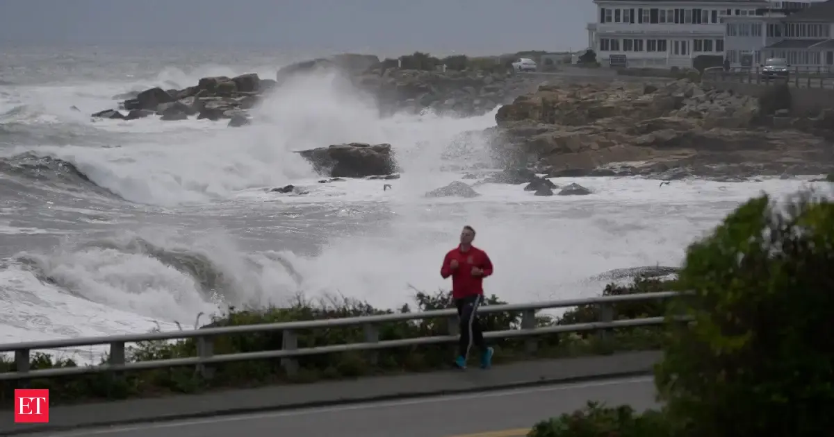
Atlantic City, New Jersey, and neighboring coastal communities along the South Jersey shoreline are contending with widespread tidal flooding and elevated water levels on September 28, 2026, following the passage of a coastal nor’easter. The National Weather Service issued a Coastal Flood Advisory for Atlantic County, warning residents and commuters that lingering onshore winds will drive water into back bays and tidal estuaries during high tide cycles throughout the day. Although the main body of the low-pressure system is advancing away from the Mid-Atlantic coast, persistent wind fields continue to trap seawater along low-lying streets and coastal thoroughfares. According to reporting by Muskan Singh, municipal officials and local emergency teams are monitoring vulnerable low-elevation areas as coastal high tides threaten to prolong inundation across barrier island infrastructure.
Key facts
What happened
The coastal flooding impacting Atlantic City is the direct result of a powerful extratropical storm, commonly known as a nor’easter, that tracked across the eastern seaboard of the United States. As the cyclone moved over the western Atlantic Ocean, it generated sustained easterly and northeasterly winds that pushed vast volumes of ocean water toward the New Jersey coastline.
Even as the primary atmospheric core of the storm begins to weaken or push farther offshore, the momentum of the displaced surface water continues to impact the shoreline. In barrier island environments like Absecon Island—where Atlantic City, Ventnor, Margate, and Longport are located—tidal dynamics are dictated by both the oceanfront surf and the narrow inlets leading to internal bay networks.
During a typical tidal cycle, water enters the back bays through inlets such as Absecon Inlet during rising tides and drains back into the ocean during falling tides. However, when strong, persistent northeasterly winds blow across the coastal ocean for multiple days, they physically block the outgoing water. This phenomenon, known as tidal stacking, prevents back-bay areas from fully draining during low tide.
When the subsequent high tide arrives, it builds upon the already elevated baseline water level. Reporting by Muskan Singh highlights that Atlantic City is experiencing significant flooding concerns primarily during these high tide cycles today. Saltwater from Absecon Bay and Beach Thorofare has spilled over bulkheads, filling storm drain basins beyond capacity and pushing water into low-lying streets. Localized street closures and water pooling have been concentrated in low-grade residential districts and commercial access corridors situated along the municipality's western and bayward perimeters.
Why it matters
Persistent tidal flooding from extratropical storms carries significant financial, logistical, and safety implications for Atlantic City and the broader South Jersey coastal region. Atlantic City serves as the primary gaming, resort, and convention hub for the state of New Jersey, welcoming millions of visitors annually and generating vital municipal and state tax revenue. When major access corridors—such as Route 30 (the White Horse Pike), Route 40 (the Black Horse Pike), and the Atlantic City Expressway—suffer tidal inundation, vehicular access into and out of the city is severely restricted. This disruption can delay service industry workers, deter day-trip tourists, and force commercial transport vehicles to navigate lengthy detours.
Beyond short-term logistical delays, repeated saltwater inundation causes long-term structural degradation to both private property and public infrastructure. Seawater is inherently corrosive; repeated exposure accelerates the deterioration of subterranean utility cables, water mains, roadway asphalt, and storm sewer networks. Motor vehicles driven through standing saltwater face immediate risk of mechanical failure and severe undercarriage corrosion.
For homeowners and business operators in low-lying sections of Atlantic City, recurring flood events complicate property management and drive up premiums under the National Flood Insurance Program (NFIP). As non-tropical nor’easters interact with gradually rising sea levels across the Mid-Atlantic region, even moderate atmospheric disturbance events now trigger tidal flooding depths that previously required major storm events, underscoring the urgent economic necessity for municipal climate adaptation and infrastructure resilience investments.
The background
Nor’easters are extratropical low-pressure systems that derive their name from the strong, continuous northeasterly winds that blow off the Atlantic Ocean onto the East Coast of North America. Unlike tropical cyclones, which form over warm ocean waters near the equator and possess warm centers, nor’easters are driven by temperature contrasts between cold air masses moving south from Canada and warm, moist air currents rising over the Atlantic Ocean and Gulf Stream. While these storms can occur at any point during the year, they are most frequent and severe between October and April.
The coastline of New Jersey, particularly Atlantic County, is uniquely vulnerable to the wind and wave dynamics of nor’easters due to its geographic orientation and coastal geometry. Absecon Island is a low-lying barrier island that sits approximately four miles off the mainland, separated by an intricate network of salt marshes, tidal creeks, and shallow back bays including Absecon Bay, Reed Bay, and Lakes Bay. Barrier islands naturally absorb the primary impact of ocean waves, protecting the mainland, but their low topography leaves them susceptible to overwash and tidal trapping.
Historically, South Jersey has endured numerous destructive nor’easters. Significant historic benchmarks include the Great March Storm of 1962 (the Ash Wednesday Storm), which caused catastrophic coastal devastation across the Mid-Atlantic, the December 1992 nor’easter, and the storm of January 2016 (Winter Storm Jonas). Additionally, hybrid events such as Superstorm Sandy in October 2012 demonstrated the overwhelming force of storm surges pushing through back-bay channels.
To communicate coastal hazards, the National Weather Service utilizes a standardized tier of advisories, watches, and warnings. A Coastal Flood Advisory is issued when low-elevation flooding is occurring or expected within 12 hours, typically resulting in zero to two feet of water above normal tide levels over low-lying roadways and land. A Coastal Flood Warning indicates a higher degree of danger, where moderate to severe tidal flooding threatens life and major property.
Reaction
Following the issuance of the Coastal Flood Advisory by the National Weather Service, local administrative bodies and emergency management personnel in Atlantic City activated standard response protocols designed for coastal weather events. Municipal public works crews routinely clear storm drains of debris ahead of high tide windows to maximize gravity-driven drainage capacity once water levels begin to recede.
Local police and emergency response services closely monitor low-elevation thoroughfares known for frequent flooding, such as streets near the back-bay docks and lower sections of access routes. When water levels overtop bulkheads, public safety officials deploy temporary traffic barricades and variable message signs to warn motorists against driving through submerged streets. Local authorities consistently advise drivers that driving through standing saltwater creates dangerous wake action that pushes floodwaters into surrounding homes and businesses while simultaneously causing severe structural damage to vehicles.
Residents and business owners in flood-prone neighborhoods habitually take precautionary measures during coastal advisories. These actions include moving personal vehicles to elevated parking decks operated by local casino-resorts or mainland facilities, securing loose outdoor items that could be swept away by rising water, and activating sump pumps in subterranean or ground-level structures.
What we don't know yet
While the current weather pattern and high tide advisory details are established, several operational and environmental factors remain uncertain following this nor’easter event. Local authorities have not yet released comprehensive assessments regarding the total extent of financial damage to public infrastructure or private property across Atlantic City and Atlantic County.
It remains unclear precisely how much beach profile loss and dune erosion occurred along Absecon Island's oceanfront during the peak of the storm. Evaluating the volume of sand swept away by wave action requires detailed post-storm geographic surveys conducted by environmental engineers and the United States Army Corps of Engineers. Furthermore, the exact duration of lingering tidal elevation remains subject to shift depending on how rapidly offshore surface winds shift from northeasterly to westerly or northwesterly directions, which is required to allow trapped back-bay waters to discharge fully into the ocean.
What to watch
In the coming days, several critical indicators will determine how quickly Atlantic City recovers from this coastal weather event and whether additional municipal interventions will be necessary:
This account is based on original reporting published by Muskan Singh.
How this story was produced
This report was written by The Global Wire newsroom from reporting first published by Muskan Singh. We verify the core facts against the original report, write our own account, and add the background and consequences a short wire item leaves out. Drafting is AI-assisted inside an editor-supervised pipeline, and every story is checked for accuracy of attribution, structure and duplication before it appears — full detail in our AI and funding disclosure.
Spotted an error? Tell us at corrections@horizonglobalnews.com and read our corrections policy or editorial standards.






Reader comments
Loading comments…