

Hurricane Polo Rapidly Intensifies into Category 5 Storm in Under 24 Hours
Hurricane Polo transformed from a tropical storm into a Category 5 cyclone in less than 24 hours on Tuesday, marking an explosive burst of intensification.
By The Global Wire Newsroom · Reported from Lydia Smith
Link preview · horizonglobalnews.com
Hurricane Polo Rapidly Intensifies into Category 5 Storm in Under 24 Hours
Hurricane Polo transformed from a tropical storm into a Category 5 cyclone in less than 24 hours on Tuesday, marking an explosive burst of intensification.
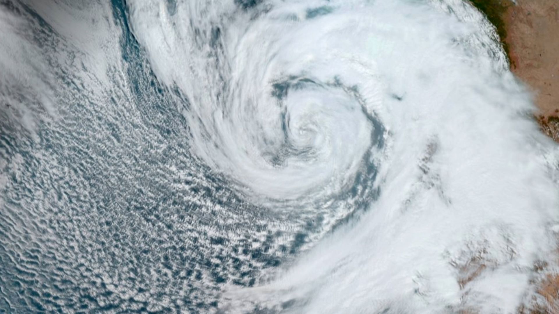
A rapidly intensifying tropical cyclone, Hurricane Polo, underwent an extraordinary surge in strength on Tuesday, September 22, 2026, transforming from a modest tropical storm into a maximum-scale Category 5 hurricane in under 24 hours. The extreme acceleration in wind speed places Polo among the most swift instances of explosive tropical cyclone intensification recorded in modern meteorological observation. Meteorological authorities and forecasting centers tracked the system as its internal structure consolidated with unusual speed, escalating the potential threat posed to coastal regions, marine traffic, and emergency response planners across the affected ocean basin.
Key facts
What happened
The rapid transformation of Hurricane Polo began early on Tuesday as the storm organized over open ocean waters. Initially classified as a tropical storm—a tropical cyclone featuring maximum sustained winds between 39 and 73 miles per hour (63 to 118 kilometers per hour)—Polo exhibited signs of sudden structural organization, according to reporting by Lydia Smith. Over the subsequent 24-hour window, the cyclone rapidly consolidated its central convection, developing a defined eye and a tightly structured inner core.
According to the reporting, this rapid evolution saw Polo pass through multiple operational storm categories in less than a single calendar day, bypassing intermediate strength plateaus to reach Category 5 intensity. Under the Saffir-Simpson Hurricane Wind Scale, a Category 5 storm sustains winds reaching or exceeding 157 miles per hour (252 kilometers per hour). To accomplish such a jump in under 24 hours, Polo's wind speeds increased by at least 84 miles per hour, more than double the standard metric used by meteorologists to define rapid intensification.
During this 24-hour window, satellite sensors monitored deep convective towers wrapping around the center of circulation. Such rapid organization typically occurs when atmospheric and oceanographic conditions align perfectly: extremely warm ocean surface temperatures, deep reservoirs of warm water below the surface, high relative humidity in the mid-levels of the atmosphere, and exceptionally low vertical wind shear. The swiftness of Polo's intensification left atmospheric scientists analyzing the precise oceanographic drivers that fueled such an unexpected leap in intensity.
Why it matters
An explosive escalation from a tropical storm to a Category 5 hurricane presents profound challenges for emergency management, public safety, and meteorological forecasting systems. When a storm intensifies at such a velocity, the window of time available for coastal communities to execute evacuation orders, secure critical infrastructure, and deploy emergency resources is compressed dramatically. Standard hurricane preparedness timelines rely on 48-to-72-hour advance warnings, which allow local authorities to stage supplies, clear evacuation routes, and advise residents to seek shelter. A storm that transitions to a maximum-intensity Category 5 system in under 24 hours severely truncates these preparation windows, heightening the risk of populations being caught unprepared by extreme weather conditions.
From a structural and environmental perspective, Category 5 hurricanes are capable of inflicting total failure on conventional residential and commercial building envelopes. Maximum sustained winds exceeding 157 miles per hour can destroy roof structures, collapse exterior walls, and convert unanchored debris into deadly projectiles. Furthermore, storms of this severity generate extreme oceanic surge—a wall of sea water pushed inland by powerful winds—which often constitutes the primary cause of fatalities and severe coastal flooding in tropical cyclone events. Power grids, water distribution networks, and telecommunications infrastructure in the path of a Category 5 cyclone face catastrophic damage that can require months to restore.
For the insurance and global financial sectors, extreme rapid intensification events raise risk profiles and alter underwriting models. Reinsurance firms and catastrophe risk modelers must account for the growing frequency of storms that defy conventional intensity forecasting, potentially leading to higher premiums and shifted risk exposure in coastal economies.
The background
To contextualize the evolution of Hurricane Polo, it is necessary to examine how tropical cyclones are classified and the physics governing rapid intensification. The Saffir-Simpson Hurricane Wind Scale categorizes hurricanes into five distinct levels based solely on maximum sustained wind speeds recorded at a standard height of 10 meters above the surface. Category 1 covers winds from 74 to 95 mph; Category 2 spans 96 to 110 mph; Category 3 ranges from 111 to 129 mph; Category 4 encompasses 130 to 156 mph; and Category 5 begins at 157 mph and above.
The United States National Hurricane Center (NHC) defines rapid intensification as an increase in maximum sustained winds of at least 30 knots (approximately 35 miles per hour, or 55 kilometers per hour) over a 24-hour period. While rapid intensification itself is not unprecedented, an escalation spanning from tropical storm strength directly to Category 5 within 24 hours sits at the extreme outer edge of atmospheric phenomena.
Atmospheric scientists have long identified three primary drivers required for extreme hurricane intensification:
In recent decades, historical precedent has shown a rising incidence of rapid intensification events across global ocean basins, including the Atlantic and Eastern Pacific oceans. Notable historical examples include Hurricane Wilma in 2005, Hurricane Patricia in 2015, Hurricane Otis in 2023, and Hurricane Milton in 2024. Each of these events highlighted how rapidly warming ocean waters can fuel sudden, catastrophic storms that challenge conventional numerical weather prediction models.
Reaction
Following reports of Hurricane Polo's rapid evolution, reactions from meteorological communities, emergency response agencies, and public safety officials center on tracking the storm's trajectory and assessing potential land threats. International weather agencies, including the National Oceanic and Atmospheric Administration (NOAA) and regional specialized meteorological centers, routinely deploy advanced monitoring assets during such events, including geostationary satellite arrays and specialized reconnaissance aircraft commonly known as "Hurricane Hunters."
While specific official statements regarding municipal evacuation orders or regional damage reports were not detailed in the original reporting by Lydia Smith, regional authorities in areas lying within the storm's potential track are expected to issue emergency advisories and activate local disaster management plans. National meteorological services typically coordinate with maritime safety authorities to issue urgent notices to mariners, advising commercial shipping and fishing fleets to steer clear of the cyclone's powerful wind field and hazardous sea conditions. Disaster relief organizations, including international humanitarian agencies, typically initiate contingency preparations when Category 5 systems develop, staging emergency supplies such as clean water, temporary shelter materials, and medical kits to facilitate rapid deployment if landfall occurs.
What we don't know yet
Several critical operational and environmental details remain unconfirmed based on the initial account of Hurricane Polo's rapid intensification. The primary reporting by Lydia Smith confirms the sudden speed of the storm's strength escalation, but leaves several key geographic and physical parameters unaddressed:
What to watch
In the days following Hurricane Polo's rapid surge to Category 5 status, observers and emergency officials will monitor several key milestones to determine the storm's ultimate impact:
This report incorporates information published by journalist Lydia Smith on September 23, 2026, detailing Hurricane Polo's rapid transition from a tropical storm into a Category 5 hurricane in under 24 hours.
How this story was produced
This report was written by The Global Wire newsroom from reporting first published by Lydia Smith. We verify the core facts against the original report, write our own account, and add the background and consequences a short wire item leaves out. Drafting is AI-assisted inside an editor-supervised pipeline, and every story is checked for accuracy of attribution, structure and duplication before it appears — full detail in our AI and funding disclosure.
Spotted an error? Tell us at corrections@horizonglobalnews.com and read our corrections policy or editorial standards.


Reader comments
Loading comments…